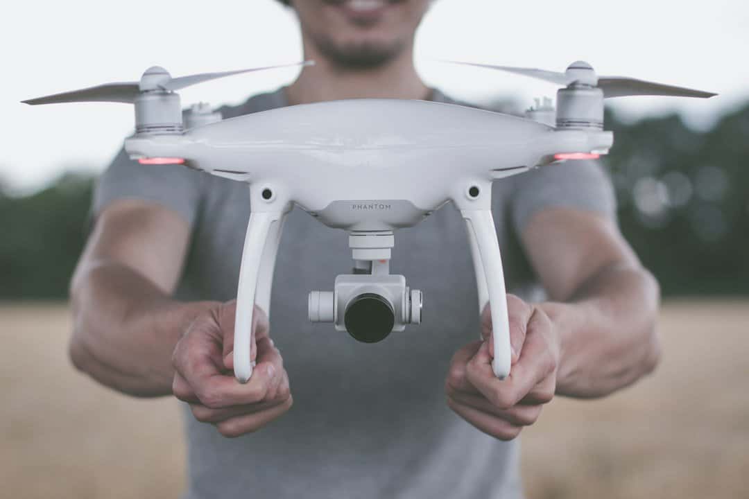
Drone technology has revolutionized various industries, and one area where it has made a significant impact is in mapping. Drones, also known as unmanned aerial vehicles (UAVs), are small aircraft that are remotely controlled or operated autonomously. They are equipped with cameras and sensors that allow them to capture high-resolution images and collect data from the air. This technology has opened up new possibilities for mapping, as it provides a cost-effective and efficient way to gather accurate data from hard-to-reach areas.
Kansas, known as the Sunflower State, has embraced the use of drones for mapping purposes. With its vast landscapes and diverse terrain, Kansas presents unique challenges for traditional mapping methods. Drones have proven to be a game-changer in this regard, allowing for more accurate and detailed mapping of the state's topography.
The use of drones in mapping offers several benefits over traditional methods. Firstly, drones provide increased accuracy and efficiency in data collection. With their ability to fly at low altitudes and capture high-resolution images, drones can produce detailed maps with precise measurements. This level of accuracy is crucial for various applications, such as urban planning, land surveying, and infrastructure development.
Secondly, drone mapping is cost-effective compared to traditional methods. In the past, mapping required expensive equipment and labor-intensive processes. Drones eliminate the need for costly equipment and reduce the time and manpower required for data collection. This cost-effectiveness makes drone mapping accessible to a wider range of industries and organizations.
Lastly, drones can access hard-to-reach areas that are challenging or dangerous for humans to navigate. Whether it's rugged terrains, dense forests, or inaccessible buildings, drones can easily maneuver through these environments and capture data that would otherwise be difficult to obtain. This ability to access hard-to-reach areas opens up new possibilities for mapping in various industries, including environmental conservation, agriculture, and disaster response.
In Kansas, drones have been utilized for a wide range of mapping projects. One notable example is the use of drones to map and monitor the state's water resources. Kansas is known for its extensive network of rivers, lakes, and reservoirs, and monitoring these water bodies is crucial for water management and conservation efforts. Drones equipped with thermal imaging cameras and sensors have been used to detect changes in water temperature, identify pollution sources, and monitor the health of aquatic ecosystems.
Another application of drone mapping in Kansas is in the field of agriculture. Drones have been used to collect data on crop health, soil moisture levels, and pest infestations. This information helps farmers make informed decisions about irrigation, fertilization, and pest control, leading to increased crop yields and reduced environmental impact.
In addition to these specific applications, drones have also been used for general mapping purposes in Kansas. They have been employed to create detailed topographic maps, assess the condition of infrastructure such as roads and bridges, and monitor land use changes. These mapping projects have provided valuable data for urban planning, transportation management, and environmental conservation efforts.
Drones play a crucial role in improving accuracy and efficiency in mapping projects. Traditional mapping methods often rely on ground-based surveys or satellite imagery, which can be time-consuming and limited in their level of detail. Drones, on the other hand, can capture high-resolution images from various angles and altitudes, resulting in more accurate maps.
Furthermore, drones can cover large areas in a relatively short amount of time. With their ability to fly at speeds of up to 50 miles per hour and cover distances of several miles, drones can collect data much faster than traditional methods. This increased efficiency not only saves time but also reduces costs associated with data collection.
One example of how drones have improved accuracy and efficiency in mapping is in the field of land surveying. Traditionally, land surveyors would have to physically visit each point on a property to collect data. This process was time-consuming and often resulted in inaccuracies due to human error. With drones, land surveyors can capture aerial images and use photogrammetry techniques to create accurate 3D models of the land. This method is not only faster but also more precise, as it eliminates the need for manual measurements.
The future of drone mapping in Kansas looks promising, with several advancements on the horizon. One prediction is the development of more advanced sensors and cameras for drones. Currently, drones are equipped with cameras that can capture high-resolution images, but there is potential for even higher resolution and multispectral imaging capabilities. These advancements would allow for more detailed and accurate mapping, particularly in areas such as agriculture and environmental conservation.
Another potential advancement is the integration of artificial intelligence (AI) and machine learning algorithms into drone mapping systems. AI algorithms can analyze large amounts of data collected by drones and identify patterns or anomalies that may not be immediately apparent to human operators. This could greatly enhance the efficiency and accuracy of drone mapping projects, as well as enable real-time monitoring and decision-making.
Furthermore, there is potential for the development of autonomous drones that can operate without human intervention. Autonomous drones would be able to navigate complex environments, collect data, and return to base without the need for human control. This would further increase the efficiency and cost-effectiveness of drone mapping projects, as well as reduce the risk to human operators.

While drone mapping offers numerous benefits, there are also challenges and limitations that need to be addressed. One challenge is the regulatory framework surrounding drone operations. In the United States, the Federal Aviation Administration (FAA) has established rules and regulations for commercial drone operations. These regulations include restrictions on flight altitudes, distances from airports, and the need for pilot certification. Adhering to these regulations can be time-consuming and may limit the scope of drone mapping projects.
Another challenge is the limited flight time and payload capacity of drones. Most drones have a flight time of around 20-30 minutes and can only carry a limited amount of equipment. This can be a limitation when mapping large areas or when additional sensors or cameras are required. However, advancements in battery technology and payload capacity are expected to address these limitations in the future.
Additionally, weather conditions can impact the feasibility of drone mapping projects. High winds, rain, or extreme temperatures can affect the stability and performance of drones, making it unsafe or impractical to fly. This limitation may require mapping projects to be scheduled during specific weather conditions or seasons.
Despite these challenges, efforts are being made to address them and make drone mapping more accessible and efficient in Kansas. The FAA has been working on streamlining regulations for commercial drone operations, allowing for more flexibility and innovation in the industry. Furthermore, advancements in drone technology, such as longer flight times and increased payload capacity, are being developed to overcome the limitations of current systems.
Drone mapping has had a significant impact on environmental conservation efforts in Kansas. Drones have been used to monitor and assess the health of ecosystems, detect changes in land cover and vegetation, and identify areas at risk of erosion or pollution.
One example of how drone mapping has been used for environmental conservation is in the monitoring of wildlife populations. Drones equipped with thermal imaging cameras have been used to locate and count endangered species such as prairie chickens and bats. This information helps conservationists track population trends, identify habitat loss or fragmentation, and develop strategies for species protection.
Drones have also been used to monitor and assess the health of forests and wetlands in Kansas. By capturing high-resolution images and using remote sensing techniques, drones can detect changes in vegetation density, identify invasive species, and assess the impact of human activities on these ecosystems. This information is crucial for land management and restoration efforts.
Furthermore, drones have been used to monitor water quality in Kansas' rivers, lakes, and reservoirs. By collecting data on water temperature, turbidity, and nutrient levels, drones can identify sources of pollution and assess the overall health of aquatic ecosystems. This information is vital for water management and conservation efforts, as well as for protecting the state's valuable water resources.
Drone mapping has become an invaluable tool in agricultural practices in Kansas. Drones have been used to collect data on crop health, soil moisture levels, and pest infestations, providing farmers with valuable information for decision-making.
One application of drone mapping in agriculture is the assessment of crop health. Drones equipped with multispectral cameras can capture images that reveal the health and vigor of crops. By analyzing these images, farmers can identify areas of stress or disease and take appropriate action, such as adjusting irrigation or applying targeted treatments. This targeted approach to crop management leads to increased yields and reduced use of fertilizers and pesticides.
Drones have also been used to monitor soil moisture levels in agricultural fields. By capturing thermal images of the soil surface, drones can detect variations in temperature that indicate differences in moisture content. This information helps farmers optimize irrigation practices and reduce water waste.
Furthermore, drones have been used to identify pest infestations in crops. By capturing high-resolution images and using AI algorithms, drones can detect signs of pest damage or infestation before they become visible to the naked eye. This early detection allows farmers to take timely action, such as applying targeted treatments or implementing integrated pest management strategies.
The use of drones in agriculture has not only improved crop yields and reduced environmental impact but has also made farming more efficient and cost-effective. By providing real-time data on crop health and soil conditions, drones enable farmers to make informed decisions and optimize their resources.
Drone mapping plays a crucial role in disaster response and management in Kansas. Drones have been used to assess damage, locate survivors, and provide real-time situational awareness during emergencies.
One example of how drones have been used in disaster response is in the assessment of damage after severe weather events such as tornadoes or floods. Drones equipped with high-resolution cameras can capture images of affected areas, allowing emergency responders to quickly assess the extent of damage and prioritize rescue efforts. This information is crucial for coordinating resources and providing aid to affected communities.
Drones have also been used to locate survivors in disaster-stricken areas. Equipped with thermal imaging cameras, drones can detect heat signatures that indicate the presence of human beings. This capability has proven invaluable in search and rescue operations, particularly in situations where time is of the essence.
Furthermore, drones provide real-time situational awareness during emergencies. By capturing live video feeds or transmitting data from onboard sensors, drones can provide emergency responders with up-to-date information on the location and movement of hazards, such as fires or chemical spills. This information helps responders make informed decisions and allocate resources effectively.
The use of drones in disaster response and management has significantly improved the efficiency and effectiveness of emergency operations in Kansas. By providing real-time data and situational awareness, drones enable responders to make timely decisions and save lives.
In conclusion, drone mapping has revolutionized the way mapping is done in Kansas. The benefits of drone technology, such as increased accuracy and efficiency, cost-effectiveness, and the ability to access hard-to-reach areas, have made it an invaluable tool in various industries.
The future of drone mapping in Kansas looks promising, with advancements in technology and regulations expected to further enhance its capabilities. Predictions include the development of more advanced sensors and cameras, the integration of AI and machine learning algorithms, and the emergence of autonomous drones.
Despite the challenges and limitations of drone mapping, efforts are being made to address them and make drone mapping more accessible and efficient. The impact of drone mapping on environmental conservation, agricultural practices, and disaster response in Kansas has been significant, and there is potential for even greater applications in the future.
Overall, drone mapping has transformed the landscape of mapping in Kansas, providing accurate and detailed data that was previously inaccessible. With its numerous benefits and potential applications, drone mapping is set to play a crucial role in shaping the future of mapping in Kansas.
If you're interested in learning more about Kansas' pioneering use of drone technology in mapping, you should check out this fascinating article on KanAerial's portfolio. KanAerial is a leading company in the field, and their portfolio showcases some of the incredible projects they have undertaken using drones for mapping purposes. From aerial surveys to 3D modeling, their work is truly impressive. To delve deeper into the topic, click here: Kansas' Pioneering Use of Drone Technology in Mapping.


